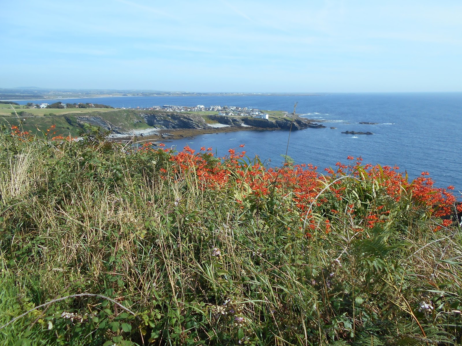
Friday, August 19, 2016

Day 50 -- Peel

Peel is an ancient port and fishing town on Man’s west coast, about 12 miles north of Port Erin. With a heavy rain falling, and forecasts for even worse weather to come, today seemed like the perfect day to visit two of Peel’s national heritage sites, Peel Castle and the House of Manannan. Seemed like.

Unlike the well-preserved Rushen Castle, where even the roofs were intact, Peel Castle is reduced to remains, with nowhere to get cover from the rain. Of course, I’m no stranger to rain, and brought with me adequate gear. The Manx are also accustomed to rain, because the audio devices for the self-guided tour were sheathed with plastic.

Peel was settled by Celts about 500 BC. Originally a place of worship, successive invasions by Vikings, English, monks and tourists turned Peel into a government center worth defending. It wasn’t long before it became a military post, and even the small church was surrounded by fortress walls thick enough to fend off future invaders. Eventually, the government moved to Castletown into a bigger and better fortress, and Peel Castle was left to suffer the fate of most castles whose usefulness expired. Still, it’s a picturesque stop, even in the rain.


Peel Harbour and Peel, viewed from castle


Adequately soaked, I then moved on to the House of Manannan, a three story building through which an indoor trail threads through the isle’s history. Interactive story boards, dioramas, and videos present Man history from early settlement to modern times, as seen through the eyes of legendary sea god, Manannan.  Although the museum covered far more history than I can absorb, it had a roof and a coffee bar.

 
Depiction of Vikings landing

When I returned to Douglas, high, wind-blown tides were crashing heavily on the shore. At least one store had placed sandbags at its front door. More heavy weather is forecast, but I’ll be inside.


Thursday, August 18, 2016

Day 49 -- Castletown

Many of my American friends have never heard of the Isle of Man, and most of my English friends have only a passing acquaintance with it. To be sure, none of my acquaintances has been able to explain exactly what a “crown dependency” is. To shed some light on the matter, I decided to delve into the history of the Isle of Man today. I started by doing my own research, using my typical reliable sources, to wit: the internet, persons I met on trains and buses, and hotel service staff, most of whom have been on the isle at least three weeks and still speak with eastern European accents. As always, my thorough research means that everything hereafter is mostly true, or at least partly true, except for the stuff I’ve made up.

Geographically, the Isle of Man is part of the British Isles (as is Ireland), and for that reason the Manx consider themselves British (but the Irish don’t, except possibly those in Northern Ireland). Politically, the Isle of Man is not a part of Britain -- it is not a part of the UK. Nor is the Isle of Man a member of the European Union. As a result, the Manx did not get to vote on Brexit.

The odd relationship between the Isle of Man and the UK apparently started in year 1405 when King Henry IV of England gave the Isle to Sir John Stanley, under condition that each successive lord pledge fealty to the English monarch and present each new monarch with two peregrine falcons at coronation. That historically feudal arrangement meant that each successive monarch of England became the Lord of Man (even if the monarch is a female, like Queen Elizabeth II). Although the Isle of Man isn’t owned by the UK, it is subservient to its feudal overlord – the king or queen of England. This may be an oversimplification, but one that explains “crown dependency” rather than UK dependency or UK territory; further, since the UK doesn’t “own” the Isle of Man, the Isle is self-governing with its own parliament.

To make sense of all of this (or at least of some of this), I went to Castletown, the former capital of the Isle of Man to tour Castle Rushen, where all of this started. Castle Rushen bills itself as one of the best preserved medieval castles in Europe (i.e., dating from pre-16th century). The castle was designed to defend the isle from marauders like the French or Spanish who would have liked nothing better than to wrest the isle away from a supporter of the English king and use it themselves as a base from which to attack England. So the English king helped defend the castle, setting the precedent that the English king will defend the Isle of Man -- and he did, at least until the English civil war, when the parliamentarians under Cromwell seized the castle.

Castletown Harbour
 
Castle Rushen
 
 
Replica of Lord's dinner
 
Historic Lords of Man
 
That brings us to the Isle of Man parliament, called the Tynwald. After touring the castle, I toured the historic House of Keys – the parliamentary building dating from the mid-1800s. The Isle of Man parliament is much older; it is the longest continuously serving parliament in the world, dating back to the Viking era in the 900s. As a parliament, it made the laws, but in the early years the parliamentarians weren’t democratically elected, and disagreements were not infrequently settled with swords and knives. But at least they got things done, unlike some of our more congenial institutions today.

Historic House of Keys

The next few hundred years get fuzzy, but I suppose it would have been hard for Cromwell’s parliamentarians and the Tynwald parliamentarians to disagree publicly, so life went on. In 1932, the Isle of Man parliament adopted as the isle's official coat of arms a depiction of three armored legs flared like a pinwheel. The image has its source in Nordic heraldry centuries old, and was accompanied by a Manx motto, a very loose translation of which is “Whichever way you throw me I will stand.” Nobody in England apparently objected, so there you have it – a self-governing crown dependency.

 
War Memorial in foreground; Castle Rushen in background


Isle of Man flag


Wednesday, August 17, 2016

Day 48 -- Bradda Head north of Port Erin, 4 miles

I returned to Port Erin today, this time to walk the headland north of the town, called Bradda Head. Bradda Head is only about half the size of the headlands I walked yesterday, so I expected a shorter day. The day became even shorter when strong winds and a narrow footpath literally inches from a precipitous edge convinced me that today was not the day to tackle this route. Instead, I moved inland to a much less dangerous footpath, trading ocean views for comfort and safety.

Premature warning
 
My poles meet the Irish Sea
Safe footpath
 
Cairn atop Bradda Head (Calf of Man in distance)
The inland footpath was much shorter, and brought me back into Port Erin right at lunch time and, as luck would have it, right past a seafood restaurant with an inviting, wind-protected deck overlooking Port Erin Bay. I took that as a good omen, had a pleasant lunch and returned to Douglas on the Steam Train.

Marina at Douglas


Tuesday, August 16, 2016

Day 47 -- Port Erin and Port St. Mary, 8 miles

At the southwest corner of the Isle of Man, a small peninsula extends into the Irish Sea. On the northwest side of the peninsula lies Port Erin. On the southeast side of the peninsula lies Port St. Mary. The two towns are a little more than a mile apart, so narrow is the peninsula. Yet, walking from one town to the other along the coastal path involves a journey of almost eight miles, numerous ascents and descents to gain each successive headland, and a time commitment of nearly 4 hours to talk to people on the trail.

Port Erin Harbour 


Port Erin from footpath

I took the 9:00 am bus from Douglas to Port Erin, arriving around 10:15. After familiarizing myself with the town’s harbor area, I started walking about 10:30. For most of the morning, I saw not another soul and made fairly good time, except for frequent pauses for pictures. The coastal path occasionally ventured only inches from a precipitous drop into the sea, but mostly stayed 10 to 30 feet from the edge. To be honest, I made better time when the path was far from the edge, and resisted the temptation to hurry when near.


Rounding the tip of the peninsula, I caught my first glimpse of Calf of Man, a smaller island just off the coast of the larger island on which I stood. A channel separates the two islands, and an impressive current was running with the changing tides. I’m told that basking sharks and porpoise frequent the area, but I didn’t see any. Hey, at my age, I’m happy just to see the trail.

Calf of Man


At the tip of the peninsula, a substantial road runs from Port St. Mary, and ends at a parking lot with a visitor center. I resisted the temptation to stop for lunch, but not the temptation to speak with the first people I met today: Janet, John, Christine and Stewart. Two are from Yorkshire and two are from Kent. I have a 50/50 chance of remembering which couple is from which location. I also have a 50/50 chance of matching the couples correctly. I’m not a wiz at math, but even I know that means I have a 75% chance of getting it wrong. So rather than insult anyone, I’ll stop here.


Continuing on around the headlands, I met Terry, Di and John. Word must have gotten out about an American who has nothing better to do than walk and blog, and Terry and John were falling all over themselves trying to get their picture into today’s posting. Fortunately for all, Di maintained decorum and managed to get Terry and John lined up (queued??) quietly on the trail so I could take a respectable picture.

John, Terry and Di
 

The trail then descended into Port St. Mary. Having successfully turned a one mile walk into an eight mile adventure, I caught the first bus back to Douglas.
 

Port St. Mary


Monday, August 15, 2016

Day 46 -- Snaefell and Laxey

I awoke to a blue sky in Douglas, with not even a cloud in sight, and a perfect day to travel to the highest point on the Isle of Man – Snaefell, a “mountain” topping out at 2,036 feet. As I did yesterday, I took the Electric Railway to Laxey, but this time rather than continue on to Ramsey, I changed cars at the Laxey station to the one that goes to Snaefell. On the ride from Douglas to Laxey, I asked the conductor about the train system. According to him, the tracks were laid in 1893, solely for the tourist trade, although now used by locals for short trips. All of the cars presently in use date from 1893 or 1895, except for the newest which went into service in 1918.

Many people had the same idea that I did, to wit: go to Snaefell in good weather. As a result, the one-car tram to Snaefell couldn’t accommodate everyone who arrived from Douglas. I wasn’t in any hurry, so deferred to the next tram. My decision was based in no small part on the conductor’s report that the summit was in cloud, but expected to clear.


That gave me an extra 30 minutes at the Laxey train station which I used to explore another historic site, the Laxey Water Wheels. Laxey is a former mining town, and large water wheels powered by a flowing creek were used to pump water from the mines. The current wheels have been nicely refurbished to demonstrate their historic function.


The ride up to Snaefell was in sunshine, but upon disembarking we were hit by 40 mph cold winds and blowing clouds. There was no view. Most passengers headed immediately for the shelter of the restaurant and ordered warm drinks. I braved the short walk to the summit to get a picture of my hiking poles at the trig point. It was too windy for me to bother removing them from the pack, so I placed my pack at the trig point, with no little trepidation that it might blow off the mountain.

View from summit

An old Spitfire sits near the summit. One could create a romantic story about the pilot heroically landing there during a storm, but in reality it was donated to the people of the area, who brought it up by the railway.


Everybody took the next trolley down, except for those still nursing their coffees. Within twenty minutes we reached the Laxey station where warm, sunny weather induced most passengers to have an ice cream and induced me to walk to through Laxey to the seashore. Except for a short interval on the summit of Snaefell, the day was as lovely as I had anticipated it would be. 

Shoreline at Laxey

Sunday, August 14, 2016

Day 45 -- Exploring Man

Yesterday on the ferry I read an article about a journalist who was heavily criticized because she labeled Isle of Man a “tax haven.” Apparently, the Manx (that’s what residents of this island call themselves) believe they are paying their fair share of taxes, and if they choose to set up a system that has no capital gains tax, no inheritance tax, and a top income tax rate of 20%, that’s nobody’s business but their own – and labeling their island as a tax haven unfairly suggests that there is something inherently corrupt about a government that doesn’t bleed its citizens dry. They are probably correct, so the last thing I’m going to do is label Isle of Man a tax haven.

But I will label it a fantasy world that no longer exists anywhere else – except in theme parks like Disneyland. Of course, the Isle of Man is not a fantasy world for its residents who go to work every day, struggle to make ends meet, and face real world challenges like the rest of us. But it is a fantasy for us tourists, where, for a brief time, we can immerse ourselves into a lifestyle that no longer exists anywhere else – if it ever did.

The first thing that caught my eye was the Douglas Bay Horse Tramway – trolleys drawn by draft horses along rails up and down the middle of the main promenade. They operate according to a published timetable, and last week celebrated their 140th anniversary. (I’ll concede that San Francisco operates nostalgic cable cars, but horses??)


I couldn’t resist taking a ride on the horse drawn tramway to the end of the line – and what do you suppose I found there? The terminal for the Manx Electric Railway. This is an electric trolley, powered through overhead cables, that runs 17½ miles between Douglas and Ramsey, an hour and a quarter ride – and it runs according to a published timetable!  At this time of year, it makes fifteen round-trips a day, leaving every hour or half-hour depending upon time of day (there are several trolleys). This isn’t just a tourist ride; it is public transportation.


At the other end of Douglas is the Isle of Man Steam Railway that runs 15½ miles to Port Erin, at the southwest corner of the island – once again, according to published timetables and with several engines. The carriages are nicely maintained and refurbished – like you would find at Disneyland, not on a typical public conveyance – but it, too, is public transportation.


I shared the carriage to Port Erin with a couple living on Man and their friend visiting from England.

Mike, Barbara and Brian

Among other things, we discussed life on the island – a few days ago, they had gone to a local agricultural show where farmers showed their sheep and cattle. (Sorry, Iain and Shayne, they didn’t mention alpacas.) Mike showed me some pictures of Loaghtan Sheep – 4-horned sheep that appear to have come straight from a Dr. Seuss sketch.

                                                     Image courtesy of Michael Cook

Perhaps I’m jumping to conclusions about a fantasy world. After all, I’ve been here only one day. I’ll update my report if I find anything more about this subject during the time I’m here. But one thing’s for sure: I’m not going to the library to research the tax structure, because affixing some labels is taboo.


Saturday, August 13, 2016

Day 44 -- Ulverston to Isle of Man

Today was a travel day – but not exactly restful – 1½ hours on the train and 4+ hours on the Isle of Man ferry. I knew the ferry would be crowded on a Saturday, so I spent an extra $24 and upgraded to the premium lounge. I’m glad I did. Virtually every seat in the general lounge was taken, mostly by families with kids shouting, crying, running around, etc. Children are not permitted in the premium lounge.

The premium lounge was only about 1/3 filled, and most of the travelers were either small groups or business people working on their computers. It was extremely quiet – even the TVs were turned down. I watched the Olympics without sound from commentators, which I thought improved the coverage.

The sea was flat. The ferry passed by several wind farms, with dozens of windmills planted in the sea, as well as a few oil and gas platforms. Fortunately, the captain was not watching the Olympics. He announced that the ferry traveled at 18 knots, which seemed about the speed the 8-oar crew teams rowed.

The Isle of Man is located in the Irish Sea, approximately equidistant from Scotland, England, and Ireland. The island, itself, is about 33 miles long and about 13 miles wide. Its highest peak has an elevation of just over 2,000 feet.

There are several main hiking routes on the island, all of which appear to be accessible from a comprehensive public transportation system. Once I get the transportation figured out, I’ll start planning some walks. It does seem strange to think about spending yet more time on transports.